Key Points
- Distance & Difficulty: 13.5 miles (21.7 km) with a difficulty rating of 6/10
- Elevation: Significant descent from Once Brewed (280m) to Brampton (60m), with undulating terrain throughout
- Key Landmarks: Vindolanda, Cawfields, Great Chesters Fort, Thirlwall Castle, and the final stretch into historic Brampton
- Facilities: Limited water points mid-route; pub stops at Twice Brewed/Once Brewed and Greenhead; WCs available at visitor centres and pubs
- Transport Links: Regular bus services and taxi options at both ends, plus exit points at Haltwhistle and Greenhead for flexible planning
Route Overview: Once Brewed to Brampton
This section of Hadrian’s Wall Path offers walkers a transition from the dramatic central ridges to the gentler, pastoral landscapes approaching Carlisle. The route covers 13.5 miles through Northumberland’s rugged beauty before entering Cumbria, passing Roman forts, quarried crags, and eventually arriving at the market town of Brampton.
Those walking this leg will experience one of the more manageable sections of the National Trail, though it shouldn’t be underestimated. The terrain varies considerably, with both ascents and descents requiring steady pacing. Self-guided walkers appreciate this stretch for its blend of archaeological sites and countryside, without the extreme elevation changes found further along the Wall.
Difficulty Rating: 6/10
This section earns a moderate difficulty rating for several reasons:
Factors Increasing Difficulty:
- Total ascent/descent: approximately 350 metres of climbing and 570 metres of descent (direction dependent)
- Several steep sections, particularly around Walltown Crags
- Rocky, uneven terrain in places requiring good footwear
- Limited facilities over middle sections
- Exposure to weather on open moorland
Factors Reducing Difficulty:
- Well-waymarked throughout
- Generally good path surfaces
- Manageable daily distance for most regular walkers
- Several exit points if needed
Fit walkers with some hillwalking experience will find this section comfortable, whilst those new to multi-day walking should allow extra time and plan rest stops carefully.
Elevation Profile and Terrain
Understanding the elevation changes helps with pacing and energy management, regardless of direction.
Walking Once Brewed to Brampton
Starting at Once Brewed (approximately 280 metres elevation), the route initially remains relatively high along the ridge system. The path undulates through the Cawfields and Walltown Crags area, with some steep descents into valleys and climbs back onto higher ground. After Walltown, there’s a general descent trend towards Thirlwall and Greenhead.
The most significant descent comes between Greenhead and the River Irthing crossing, dropping from around 170m to 80m. From there, the route gently descends across agricultural land to Brampton at approximately 60 metres elevation.
Walking Brampton to Once Brewed
Those heading in the opposite direction face a more gradual ascent initially, climbing from Brampton’s 60 metres through farmland to the Irthing valley. The steepest sections come after Greenhead, with challenging climbs around Walltown Crags and through the central Wall country. The cumulative ascent feels more demanding in this direction, making it slightly tougher overall.
Wayfinding and Navigation
Hadrian’s Wall Path is exceptionally well-signposted with the distinctive National Trail acorn symbol and regular Hadrian’s Wall Path markers. Between these endpoints, the route is clearly defined with wooden waymarkers, gates with trail arrows, and occasional interpretive panels.
Navigation Highlights
Strong Waymarking Sections:
- Once Brewed to Cawfields (excellent signage near visitor facilities)
- Walltown Crags area (frequent markers and well-trodden path)
- Greenhead village (clear urban waymarking)
- Approaches to Brampton (good town signage)
Areas Requiring Extra Attention:
- Field crossings between Greenhead and Brampton can be less obvious after rain when paths are muddy
- Farm track sections where the route joins access roads briefly
A basic OS map (OS Explorer OL43) or GPS app provides reassurance, though most walkers complete this section without navigation difficulties. The path is well-used, creating a clear track even in summer grass.
Water Points and Toilets
Planning for facilities is essential on this section, as the middle stretch has limited amenities.
Water Refills
- Once Brewed/Twice Brewed: Pubs and visitor facilities at the start
- Vindolanda: Visitor centre with café (seasonal opening; small entrance fee unless just using facilities)
- Walltown Quarry: Public toilets with water tap (seasonal, typically Easter to October)
- Greenhead: Village shop, hotel, and pub
- Brampton: Full town facilities including shops, cafés, and pubs
Carry sufficient water capacity (1–1.5 litres minimum) as the stretch between Once Brewed area and Greenhead offers limited guaranteed refill points, particularly outside visitor season.
Toilet Facilities
Public WCs are available at:
- Twice Brewed Inn (customers)
- Vindolanda Museum (entrance fee or ask politely)
- Walltown Quarry car park (seasonal, free)
- Greenhead Hotel and pubs (customers)
- Brampton town centre (public toilets near tourist information)
Lunch Stops and Pubs
Twice Brewed Inn / Once Brewed Youth Hostel Area
At the route’s starting point (or end, depending on direction), the Twice Brewed Inn offers hearty pub meals with views across Northumberland. The adjacent Sill visitor centre has a café serving lighter options. Both are popular with walkers, so expect company.
Greenhead Village
Approximately 8 miles along (whether starting from Once Brewed or Brampton), Greenhead provides the main mid-route refreshment opportunity. The Greenhead Hotel welcomes walkers with traditional pub food, whilst a small village shop stocks snacks and drinks. This is the ideal lunch stop for most walkers, breaking the day into manageable halves.
Brampton
The market town of Brampton offers numerous options, from cafés to traditional pubs. Walkers finishing here can explore the town’s historic market place and several coaching inns. Those starting from Brampton should note that once departed, facilities are sparse until Greenhead.
Pack a Backup
The stretch between these settlements crosses open countryside and farmland with no facilities. Carrying emergency snacks and drinks ensures comfort if plans change or walking pace differs from expectations.
Public Transport and Exit Points
Flexibility is one advantage of walking Hadrian’s Wall Path, with several options for shortening or extending days.
Once Brewed / Twice Brewed
Bus Services:
- AD122 Hadrian’s Wall Country Bus (seasonal service, typically Easter to October)
- Connects to Hexham, Haltwhistle, and Carlisle
- Service approximately every 2 hours during operating season
Taxi Services:
- Readily available from local firms
- Pre-booking recommended, especially for early morning or evening pickups
- Typical journey to Haltwhistle railway station: 10 minutes
Greenhead (Mid-Route)
An excellent mid-point exit, Greenhead village sits directly on the route.
Bus Services:
- AD122 seasonal service
- Some limited year-round services to Haltwhistle and Carlisle
Taxi Options:
- Local taxi firms service the village
- Useful for baggage transfers or weather-related route changes
Brampton
Bus Services:
- Regular buses to Carlisle (approximately 9 miles)
- Some services connect to Haltwhistle
- More frequent services than remote Wall sections
Taxi Services:
- Multiple local operators
- Easy access to Carlisle and railway connections
Railway Access:
- No direct station, but Carlisle (20 minutes by bus) offers extensive rail connections
Self-guided walking packages typically arrange baggage transfers between accommodations, but understanding public transport options enables flexible planning if weather, fitness, or timing requires adjustments.
Points of Interest Along the Route
Just south of the Wall line, Vindolanda offers Britain’s finest Roman excavations. The museum houses remarkable finds including leather shoes, wooden objects, and the famous Vindolanda tablets. Walkers with time to spare will find a detour rewarding (allow 1–2 hours for a proper visit).
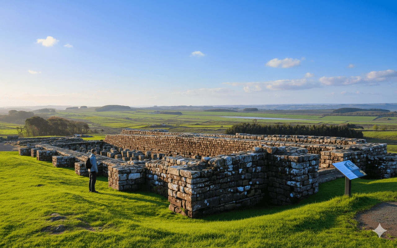
Cawfields Quarry and Wall
The dramatic quarry site demonstrates both Roman engineering and Victorian industry. The Wall here sits atop Whin Sill crags, showcasing the frontier’s defensive positioning. Cawfields also provides a good rest spot with interpretation boards.
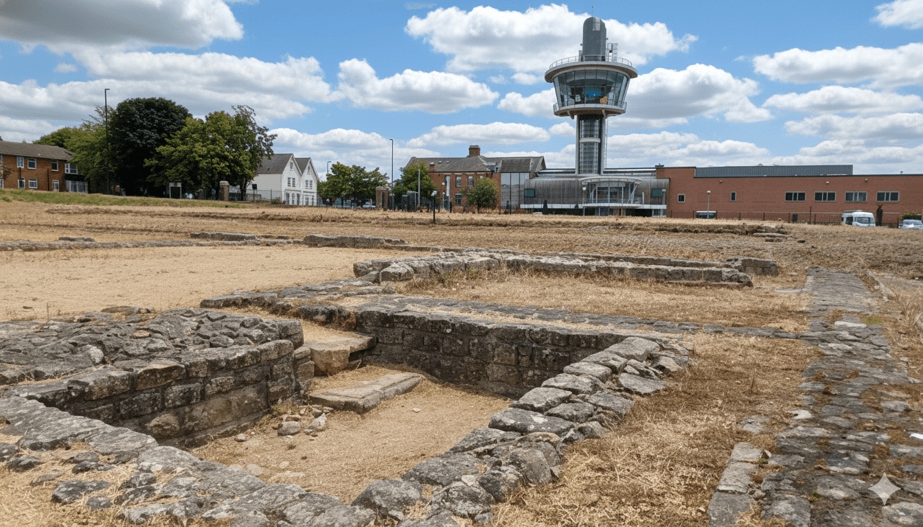
The fort remains are subtle compared to others, but their isolated position evokes the reality of Roman frontier life. Information boards explain the site’s archaeology and strategic importance.
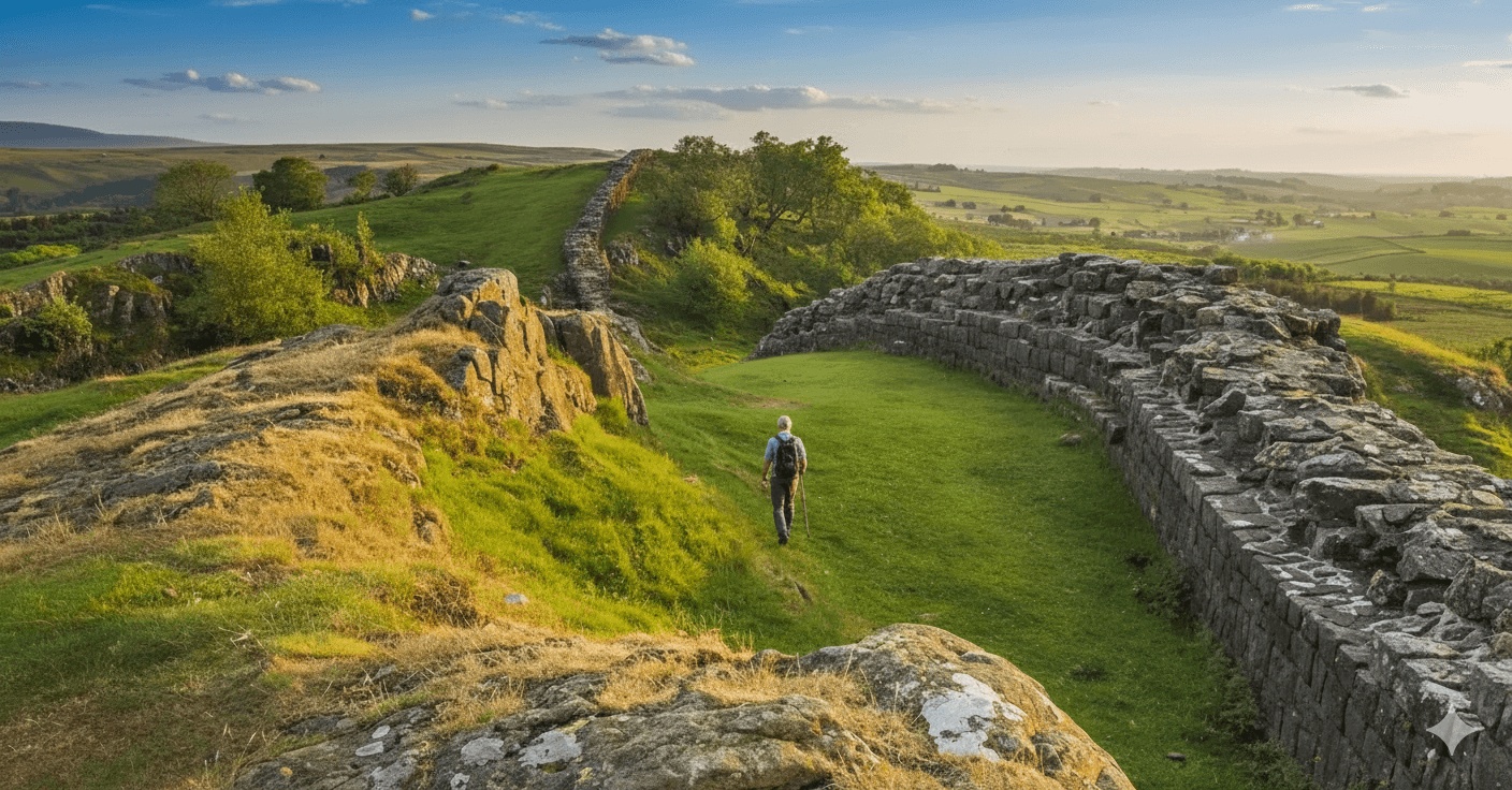
Walltown Crags
Perhaps the most photogenic section, Walltown’s limestone crags show off the Wall’s dramatic positioning. The nearby Walltown Quarry visitor area includes a Roman Army Museum (separate attraction requiring tickets), public facilities, and panoramic views.
Thirlwall Castle
This 14th-century fortified manor house, built partially from Roman stones, marks the landscape transition as the route leaves the highest Wall sections. The ruins stand atmospheric near the Tipalt Burn.
River Irthing Crossing
The descent to and crossing of the River Irthing provides one of the route’s prettiest moments. The valley’s woodland and riverside paths contrast with the open moorland walked previously.
Brampton
This Georgian market town rewards walkers with attractive architecture, Moot Hall, and St Martin’s Church (containing William Morris designs). The town makes an excellent base for exploring this section or continuing along the trail.
Weather Considerations
Northumberland and Cumbria’s weather can change rapidly. The exposed sections between Once Brewed and Greenhead offer little shelter in poor conditions.
Essential Precautions:
- Waterproof jacket and trousers (not water-resistant – truly waterproof)
- Multiple layers for temperature regulation
- Warm hat and gloves even in summer months
- Sun protection in clear weather (the ridge sections are exposed)
The section between Walltown and Greenhead can be particularly wind-swept. Those walking in winter should note short daylight hours and potentially treacherous conditions underfoot. Many self-guided walking operators offer flexible booking allowing date changes if weather forecasts suggest dangerous conditions.
Accommodation Options
Both Once Brewed/Twice Brewed and Brampton offer accommodation ranging from pubs with rooms to B&Bs and hotels.
Once Brewed Area:
- Youth hostel (budget-friendly dormitory and private rooms)
- Twice Brewed Inn (pub accommodation)
- Several B&Bs within short distance
Brampton:
- Market town with greater choice
- Several hotels, guest houses, and B&Bs
- Better suited for rest days with shops and facilities
Self-guided walking packages handle accommodation booking and baggage transfer, allowing walkers to carry only day packs. This transforms the experience, particularly on challenging sections where full pack weight would increase difficulty significantly.
Planning Your Walk
Timing and Seasons
Spring (April–May):
- Wildflowers emerging
- Lambing season (dogs must be under close control)
- AD122 bus service begins operating
- Weather unpredictable but days lengthening
Summer (June–August):
- Longest daylight hours
- Warmest temperatures (but carry waterproofs)
- Busiest period on the trail
- All facilities open
Autumn (September–October):
- Beautiful moorland colours
- Clearer visibility often
- Fewer walkers than summer
- AD122 service ends mid-October
Winter (November–March):
- Short days requiring early starts
- Potential for snow and ice
- Some facilities closed
- Reduced bus services
- Most challenging conditions but rewarding for experienced winter walkers
Fitness Preparation
This section requires moderate fitness. Walkers should be comfortable with:
- 5–7 hours walking time (plus stops)
- Uneven terrain and stone steps
- Hill ascents and descents
- Carrying day pack with water, food, and weather gear
Training on local hills before departure ensures enjoyment rather than endurance test.
Making the Most of Your Self-Guided Walk
Self-guided walking holidays offer the perfect balance of structure and freedom. Accommodations and baggage transfers are arranged, but daily pace, start time, and stops remain entirely flexible. This section particularly benefits from this approach:
- Start early to enjoy quieter trails and morning light on the Wall
- Take time exploring archaeological sites without schedule pressure
- Adjust lunch stops to match personal walking speed
- Build in photography stops without affecting group dynamics
The beauty of self-guided walking lies in this autonomy. Some walkers complete the section briskly in 5–6 hours; others extend it to a leisurely 7–8 hours with extended breaks. Both approaches work perfectly when accommodation awaits at day’s end and luggage has travelled ahead.
Frequently Asked Questions
How long does it take to walk between Once Brewed and Brampton?
Most walkers complete this 13.5-mile section in 6–7 hours including breaks. Faster walkers may finish in 5 hours, whilst those taking extended stops for photography, site visits, or lunch might take 8 hours. The terrain is moderate with steady ascents and descents, so pacing is important. Allow extra time in poor weather when paths become muddy and visibility reduces.
Can I walk this section in reverse from Brampton to Once Brewed?
Absolutely. Hadrian’s Wall Path is walked in both directions, though the traditional west-to-east route is slightly more popular. Walking Brampton to Once Brewed means facing more of the climbing later in the day as you approach the higher terrain around Once Brewed. The cumulative ascent feels more noticeable in this direction, but navigation remains straightforward and facilities are accessible either way.
Where can I catch a bus if I need to finish early?
Greenhead village sits roughly halfway along this section and offers the best mid-route exit point. The AD122 Hadrian’s Wall bus (seasonal, Easter to October) connects Greenhead to Haltwhistle station and Carlisle. Outside the AD122 season, some limited year-round services operate. Local taxis are also available from Greenhead, making it the most practical bail-out point. At either end, Once Brewed/Twice Brewed and Brampton both have bus connections and taxi services.
What’s the most challenging part of this section?
The terrain around Walltown Crags presents the most demanding walking, with steep sections both ascending and descending the limestone escarpment. The rocky, uneven surface requires concentration and good ankle support. Direction matters here – those walking from Once Brewed face more descending, whilst those heading towards Once Brewed must climb these steep sections. The exposure to weather on the open ridges can also increase difficulty if wind and rain arrive.
Are there shops for food supplies along the route?
Greenhead village has a small shop stocking basic supplies, sandwiches, and drinks. However, this is the only on-route shop between Once Brewed and Brampton. Stock up on snacks, lunch items, and sufficient water before departure, particularly if walking outside summer months when some facilities may be closed. Both Once Brewed area and Brampton have better shopping facilities at either end of the section.
Is the path suitable for walking in winter?
Experienced winter walkers can complete this section year-round, but several factors require consideration. Daylight hours are short (approximately 7–8 hours in December–January), so early starts are essential. Snow and ice can make exposed sections treacherous, particularly around Walltown Crags. The AD122 bus doesn’t operate, reducing transport options. Some facilities including Walltown Quarry toilets close seasonally. Winter walking demands proper equipment, experience, and careful weather monitoring. Many self-guided operators offer this section primarily March through October for these reasons.